Map of Esan Land
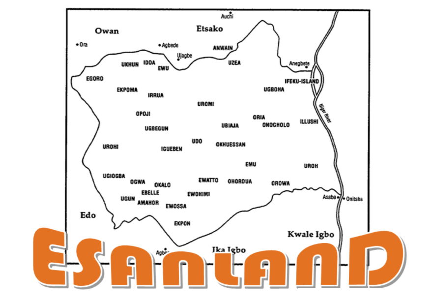
Geographic Location and Map of Esan Land
Esan land (Otoesan) has an area of 2,814,347 square kilometres. It lies between the fringes of the Savannah to the North and the forest (Rain forest) to the South. The plateau on the northern fringes has the forest vegetation which thinned into the northward Savannah. It is made up of Sandy topsoil that could easily be cleared and cultivated, relatively weed-free. It lies West of the banks of the River Niger and it is bordered by the Edo South and North Senatorial districts, Kogi state and Delta state.Geographically, Esan land is located at Longitude 605 degree Celsius and Latitude 605 degrees Celsius. It has boundaries on the North West with Owan and Etsako.
Esan land is bordered to the south by Benin, to the South-east by Agbo, to the North and East by Etsako, to the West by River Niger. The land is about 80km North East of Benin city. By this factor of proximity and the fact that they share a basic cultural substratum, they are regarded as neighbors with Bini. From Ewu to Benin City, the State capital is 100km away. The people populate areas such as Uromi, Ewatto, Irrua, Ubiaja, Ewohimi, Ebele, Ewu, Ekpoma, Eguare, Iruekpen, Igueben, Ehor, Egoro Eguare, and others in central Edo state; of the South-South region of Nigeria.
Otoesan has a flat landscape devoid of rocks and mountains, and good for agricultural purposes. Studies have shown that the relatively flat terrain of Esan land has an average slope of about 1838 on the surface and an elevation format between 350-466m above sea level. The peak on this plateau exists at the Uromi chiefdom with 466m above sea level. Otoesan has a rich topsoil full of humus and sandy, light brown soil with finely ground sand and clay. This has been responsible for good crop yield in the region, especially yams. The position of Esan land in a favorable climatic zone enhanced the initial agricultural development and the entire economic structure of the area.